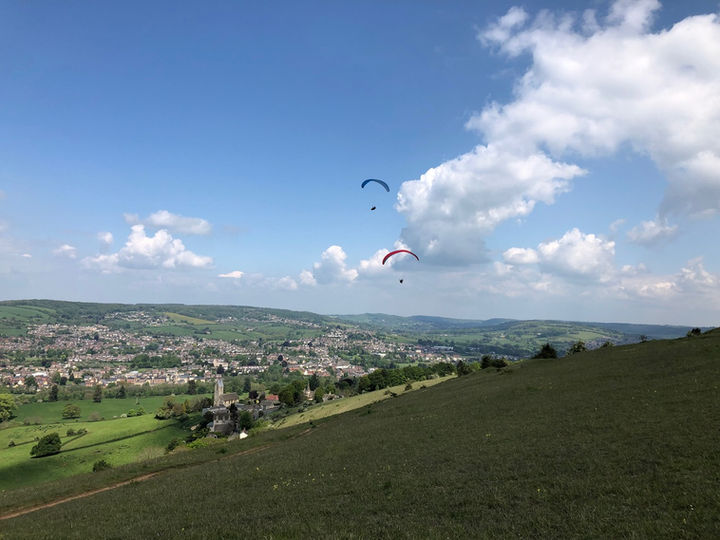

Selsley Common

Wind directions:
NW,NNW
Click for full site map

Location:

Site News
Parking
Permission:
Open
Site Officer:
Dave Warren
Restrictions:
None
Lat, Long:
51.727247 N 2.251875 W
Launch height (ft)
690
Grid ref:
SO 827 032
Height TTB (ft)
300
Pilot Rating:
Club Pilot
Take off
About 400m from the road on the NW facing slope. If the modellers are flying, their area is west of the millennium-memorial stone. Please do not fly or rig in this area. There is a deep quarry immediately NE of takeoff to be avoided especially in stronger launch conditions.
Local Flying
Selsley offers good ridge-soaring in a NW wind. Always get briefed by a local pilot before flying There is a factory chimney to the NW which can help indicate wind direction. The site is friendly for a paraglider if conditions are gentle. If you are going down, slope land early to avoid turbulence behind the trees at the bottom of the slope. The shoulder to the NE of take-off is a good place to land. Keep a look out for modellers using the ridge and stay East of the memorial stone unless you have substantial height. Beware of the wind gradient and sudden turbulence in winds of 16mph or more, especially if the wind goes either East of North or West of North-west.
If the wind is west of NW you should move to Frocester. The West face of the common is not flown as turbulence has been experienced here.
If you are planning to fly the ridge-run towards Frocester, leave the West end of the site with good height before heading across the bowl to connect with Penn Wood, the spur on its far side. There are several power lines and horses kept at the base of this bowl so landing options are limited and technical.
XC Flying
The site has excellent possibilities with goal flights to Arundel having been achieved. If you have not flown XC from Selsley before, leave the Common with plenty of height or climbing strongly before crossing the deep Nailsworth valley behind.
Top Landing
Land anywhere on the common, with the exception of any area being used by modellers. The area behind the take-off and the quarry can be turbulent in strong conditions, therefore land further back.
Bottom Landing
The field directly below take-off to the North of the road and West of the church. Be aware you will be flying over the road to get to the field. The road has a power line running along it and the field itself has a power line crossing its NE corner. The field also dips in the middle. Exit this field by the gate and walk East along the road until you reach the footpath to the common.
If the field has young livestock in it the farmer (Mr. King) may well need us to use the flat field immediately SW. This will be notified by Telegram. Please do not land in any other fields as this has caused friction in the past, and do not drive into a field or farm access track to retrieve pilots and equipment. In case of any incident requiring the farmer to be contacted this can be done via the sites officer.
Additional Info


