Flying Articles & Related Resources - General Flying
eNova Archive | Safety | General Flying | Club Archive | There I Was... | Coaching | Video Reviews | Firefly's Flying Diary | Frequently Asked Questions | Low Airtimers
XC Airspace Primer
| Date: | 01/04/2000 | ||||||||||||||||||||||||||||||
| Author: | Chris Jones | ||||||||||||||||||||||||||||||
| Position: | Safety Officer | ||||||||||||||||||||||||||||||
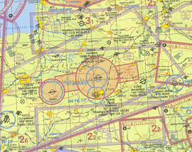
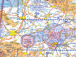
This article is a companion to the low airtimers airspace talk I gave at the April 2000 club night. It isn't an "everything you need to know guide to airspace" but should serve as a as a starting place for a more thorough study of the rules. If you spot a mistake let me know! It is important that you know the rules, more important than any qualification. The airlaw rules are there for one reason only and that is safety. The air over the UK can be a crowded place and all of us that use it must follow a common set of procedures. Airlaw is there so we all know what is expected of us and what we can expect from others. Just like the rules of the road. We're the pedestrians of the air so we'd better watch out for other traffic and stay off the busy streets unless we know what's what. Having said that, first timers shouldn't be intimidated, get an airmap and study it at home to become familiar with it. The Jeppesen 1:500,000 style of map There are several types of airmaps available. Most people either fly with a CAA 1:500,000 or 1:250,00 chart. Jeppsesen have just produced a set of 1:500,00 VFR/GPS charts. I don't think they are as suitable as the CAA ones though they do have GPS co-ordinates on them and are quite clear to read, check them out. Get a 1:500,000 and maybe a local 1:250,000, which may help your navigation. The only problem with a 1:250,000 map is that is does not show airspace above 5000', you have to mark it on yourself. It may also be a good idea to get a road map and mark the airspace from YOUR airmap on it as you may find it easier to navigate with. It all depends on how far you intend to fly! There is no legal requirement to carry a map, just to obey airlaw, which will be difficult if you don't know where the airspace is! If you use a GPS make sure it shows airspace or carry a map with airspace marked as well. CAA 1:500,000 Map Whatever map you choose get to know it and make sure it is up to date. Maps are updated nearly every year. Fly fantasy XC's at home. Visualise what you intend to do. It will make things easier when you do it for real. Mark on the map possible routes for various likely wind directions. Highlight features that will help you navigate such as railway lines, canals, HT power lines, motorways or prominent towns. Also mark areas of airspace that you are not allowed to enter, this will help with your decision process when you are actually flying. "Can I enter that restricted area?" Mark it in BIG letters. Here are some points to keep on mind: In the UK we will generally be flying in Class G airspace which is uncontrolled. We fly to VFR (Visual Flight Rules) in VMC Visual Meteorological Conditions. That is:
The more alert of you will notice that this means above 3000' we should not be circling to cloudbase. Thankfully it is accepted practice for gliders outside of controlled airspace to circle to cloudbase. When flying Ubley we are in Class "D" and special rules apply - find out what. When flying over towns and such like we must maintain at least 1500' above the highest object within a 600m horizontal radius. We must also be able to land clear. You are OK though if you are taking off or landing. But don't go scratching at 750' above Glastonbury town centre. Don't go flying low over the Glastonbury festival either as we must maintain 3000' within 1000 meters of a gathering of 1000 people or more. "Sorry officer, I could have sworn there were only 999" is no excuse. Then there is the 500ft rule which I'll leave as an exercise for you to discover. CAA 1:250,000 Map Types of airspace to stay out of (rather a lot).
Types of airspace to be very careful in.
Set you altimeter(s) before you fly. If you intend to fly XC set your altimeter to the height of take-off amsl, QNH or altitude. That way you will be able to easily figure out our altitude with respect to any airspace you encounter. e.g. You know that an ATZ extends for 2000' above an airfield. The number on the map tells you that the airfield is at 350' amsl, so you must maintain 2350' amsl to clear the ATZ. If you have another altimeter set it to show QNE or flight level. This will help you cope with Airways, CTA etc. FL65 is approximately 6500' amsl. Using this type of measurement ground zero is taken to be where the pressure reads 1013.2 Mb. So if the pressure at sea level is less than 1013.2 FL65 will be lower than 6500' amsl and if it is greater FL65 will be higher. If you don't have two altimeters make allowances for this if you expect to encounter airspace that uses flight levels to mark its boundaries. Other pointsOnce underway, at all cost avoid a collision. Keep a sharp lookout and make yourself visible if you spot another aircraft close by. Bank up and show as much sail as you can. If you have to, loose height to lessen the risk of a collision. Don't forget other gliders especially if flying in the wisps at the base of a cloud. Planning is the key to success. If you know where you are, where you are going and what lies ahead your flight will be 100 times less stressful. You'll probably fly further to, as your brain will be able to spend more time helping your core that thermal to the max. Above all (pun intended) fly safe. You're responsible for the safety of others as well as your own. More detail can be found here:
|
|||||||||||||||||||||||||||||||
We've had some good feedback already about this section - thanks! The more eagle-eyed will note that I've done some more work on it too. If you have any articles you'd like us to include, please email them to me.


